Kopterflug deploys the Flyability ELIOS 3 for mining inspections – in shafts, tunnels, crusher plants and stopes, above and underground. No human entry, no scaffolding, no waiting for access permits. LiDAR delivers centimetre-accurate 3D models; 4K and thermography document cracks, corrosion and hotspots.
Mining operations run shafts, tunnels, stopes and crusher plants that must be regularly inspected for structural damage, rock movement and wear. Conventional entry into unstable, deep or poorly ventilated areas is time-intensive, dangerous and often simply not possible for personnel.
In active mines, Post-Blast surveys after blasting are among the most critical – and most dangerous – tasks. Every hour of waiting for personnel clearance costs production time. Decommissioned installations and aftercare areas present their own challenges: documentation without personnel in potentially unstable zones over decades.
The Flyability ELIOS 3 flies into shafts, tunnels, crusher plants and transfer points – above and underground, GPS-independent, without human entry. LiDAR delivers centimetre-accurate 3D models for geometry comparisons and volume calculations. 4K video and thermography document cracks, corrosion and hotspots.
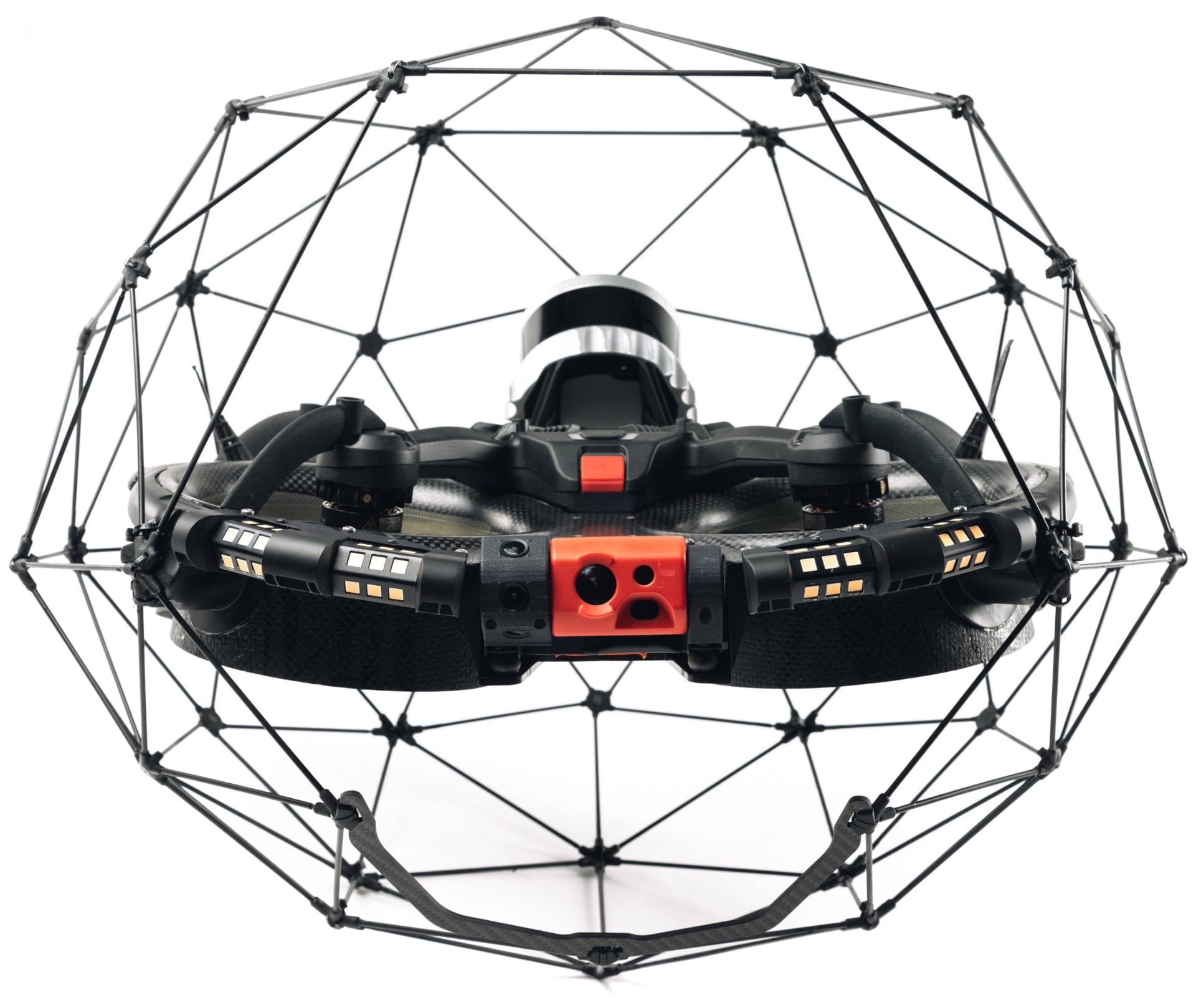
The Flyability ELIOS 3 with its collision-safe carbon cage – purpose-built for underground mining environments.
GPS-free SLAM navigation – critical underground without satellite signal. Collision-tolerant cage for tight, irregular rock geometries. Thermography for early fire detection and ventilation monitoring. No human entry into restricted areas.
External inspection of headframes, spoil tip structures, winding towers and opencast edges. 200× zoom and thermography. Structural condition documented without scaffolding or rope access.
Ground-level 3D capture of tunnel profiles, crown profiles and support cross-sections. No tripod, directly usable in tunnels. Output E57/LAZ for geomechanical evaluation and stability assessment.
LiDAR-based Simultaneous Localization and Mapping operates completely without GPS – indispensable underground. 3D point cloud (Ouster OS0-128, centimetre-accurate, 1.31 million points/s) is generated in real time.
We inspect with the ELIOS 3 above and underground – GPS-independent, collision-safe, without human entry into hazard zones. Geotechnical evaluation is carried out by your geotechnicians and surveyors – we supply the data:
| Area | What We Check | Why It Matters |
|---|---|---|
| Shafts & Stopes | Wall structures, cracks, void formation, rock support, blast breakouts, water ingress, blockages | Post-Blast surveys and stability checks require rapid access after blasting – without waiting for personnel entry |
| Tunnels & Underground Drifts | Cracks, voids, support failures, water ingress, wear on lining, geometric changes over time | Regular documentation of unstable drifts without human entry is the decisive safety advantage |
| Crusher Plants & Silos | Liner wear, deposits and blockages, mechanical damage, hotspots on drives | Early detection of wear prevents unplanned shutdowns in hard-to-access structures |
| Decommissioned Areas & Aftercare | Void formation, settlement, water ingress, corrosion on remaining fixtures, geometric changes | Aftercare obligations require regular documentation over decades without personnel in unstable zones |
We deliver 4K video, LiDAR point clouds and a structured inspection report with marked findings. Geotechnical assessment and surveyor documentation are handled by your specialists – we supply the data they are based on.
With the Flyability ELIOS 3 we inspect critical areas above and underground – safe, precise and without human entry. Centimetre-accurate 3D scans with Surveying Payload + FARO integration available:
Post-Blast surveys, rock support monitoring, void and crack detection – GPS-free, from a safe distance. Centimetre-accurate 3D scans with Surveying Payload for dimensional documentation and stability assessment.
Wear control without shutdown or entry. Thermography detects hotspots and mechanical problems early.
Inspection of walls, fittings and deposits without human entry. LiDAR measures geometry and deposit height precisely.
Inspection of support structures, roller stands and roofing without scaffolding or rope access. Thermography detects bearing problems and overheating early.
ROV inspection of flooded shaft sections, water management systems and underground water bodies – without divers, without dewatering. Wall condition, sediment deposits and fittings fully documented.
Documentation in decommissioned mine workings without human entry. Condition assessment for aftercare obligations, regulatory reports and long-term monitoring.
Large-volume voids after extraction – often no longer accessible. 3D scan for volume determination, stability assessment and documentation without entry.
First inspection directly after blasting from a safe distance – before any personnel enter. Significant safety gain: no-go zones are fully documented before the team enters.
Vertical and horizontal ventilation drifts – often extremely difficult to access. ELIOS 3 documents constrictions, deposits and structural damage without human entry.
Vertical ore shafts and bunkers – one of the most hazardous areas in mining (blockages, collapse risk). ELIOS 3 documents completely without personnel in the hazard zone.
Inspection of areas around pumps and water management systems. ELIOS 3 for dry and partially filled areas, ROV for fully flooded sections.
Inspection of utility pipes, power supply and trackwork in underground drifts. Damage from rock pressure, moisture and mechanical loading.
Inspection of overhead zones (crown) that are barely visible from the floor. Extremely safety-critical – crack formation and spalling are not recognisable from below.
Historic or disused mine workings – condition often unknown. 3D documentation for stability assessment and archiving without human entry.
Material transfers between conveyance drifts – high abrasive wear and blockage risk. Drone documents without operational interruption.
| Aspect | Conventional (entry / rope access / survey teams) | Flyability ELIOS 3 |
|---|---|---|
| Human entry | Required – full safety chain, gas measurement, rescue standby, DGUV entry | No entry – drone flies in, team stays outside |
| Navigation | Manual – limited by body size and safety overhead | GPS-free SLAM navigation – stable in complete darkness, hundreds of metres underground |
| Post-Blast access | Wait hours to days for gas clearance and safety release | Fly immediately after blasting – first-pass survey within minutes |
| Sensors | Handheld camera, manual measurements – spot checks only | 4K + thermography + LiDAR 3D in a single flight |
| Preparation | Safety measures, permits, entry procedure – hours to days | Gas measurement, access point – deployment in hours |
| Result | Subjective inspector report, not reproducible | Structured findings report, position-referenced, repeatable |
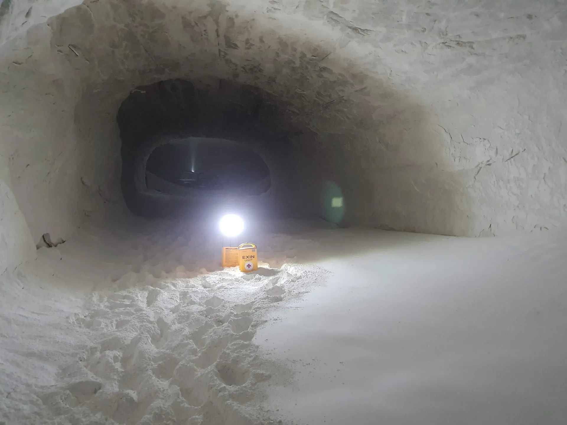
Kopterflug on-site in underground mining – documentation without any personnel in the hazard zone.
We analyse your requirements and advise you free of charge on all technical and organisational questions. Which assets, what frequency, what data?
You receive a transparent quotation. Together we plan the timing, access and safety concept – coordinated with your HSE team and, where required, the relevant mining authority.
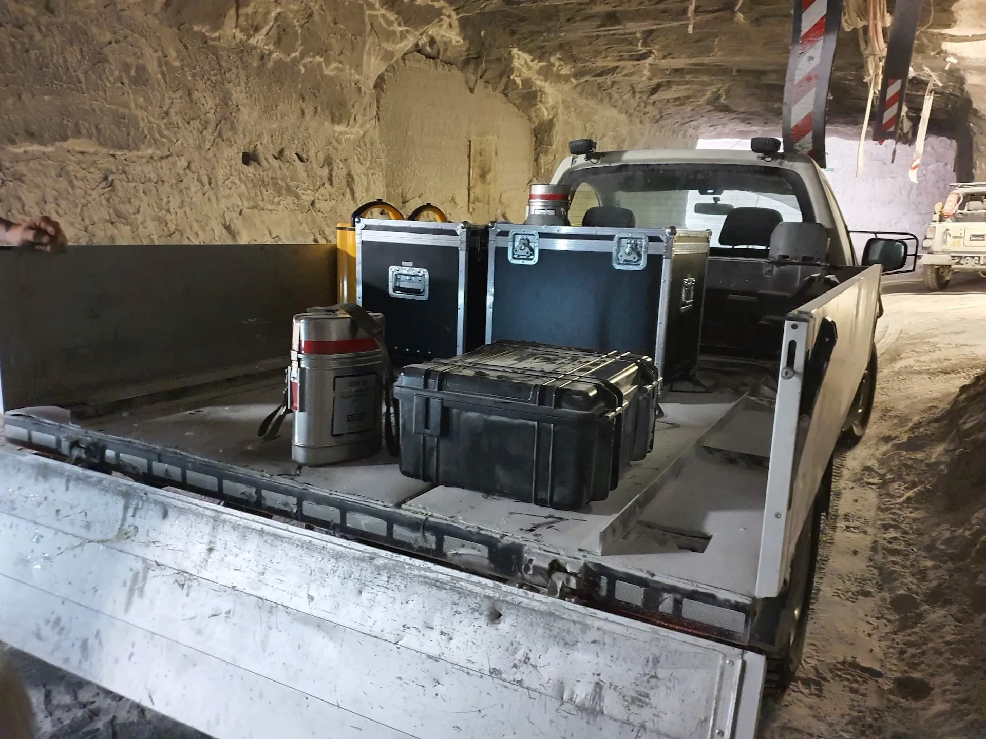
We carry out the inspection with state-of-the-art drone technology – usually within a few hours. No scaffolding, no separate confined space entry preparation.
You receive a detailed report with 4K footage, 3D models, thermography analyses and a systematic findings overview. Suitable as a basis for your geotechnicians, surveyors and regulatory submissions.
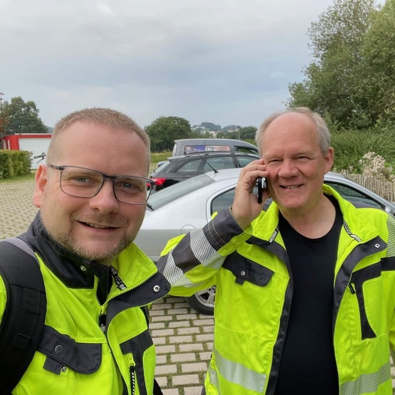
Christian Engelke and Dipl.-Ing. Karsten Lehrke – your direct contacts for mining inspection projects.
Since 2017, Kopterflug has been deploying drones in complex industrial environments. We understand the special requirements of mining: the highest safety standards, unstable areas, precise surveying without human entry.
Christian Engelke and Dipl.-Ing. Karsten Lehrke are your direct contacts for technical questions – deployment planning, safety concepts, coordination with mining authorities.
Deployment is generally possible and is used worldwide in various mining applications – particularly for inspecting hard-to-access or hazardous areas. Permissibility always results from the operational risk assessment and applicable safety regulations (DGUV, BBergG, site-specific mining authority requirements). We coordinate every deployment in advance with your HSE team and the relevant authority.
Yes, and this is an area where the drone excels. Decommissioned shafts, inaccessible voids and areas with ongoing aftercare obligations (“Ewigkeitsaufgaben”) can be documented without human entry – safely, cost-effectively and without risk to the inspection team.
Yes. Indoor drones like the ELIOS 3 use SLAM navigation (Simultaneous Localization and Mapping) – they orientate themselves by the surrounding structures and create a 3D map of the environment without satellite signal. This works reliably hundreds of metres underground, in complete darkness and in geometrically complex voids.
LiDAR generates centimetre-accurate 3D point clouds of voids, shafts and tunnels. In practical use, accuracy is typically in the centimetre range, depending on ambient geometry, dust loading and data processing. This allows volumes to be calculated, geometry changes compared over time and distances precisely measured – a reliable basis for geotechnical assessments and surveyor documentation.
Typical findings: cracks and spalling in rock or lining, deformations and newly formed voids, water ingress and moisture trails, corrosion or wear on fittings and plant, deposits and blockages in shafts and silos. The assessment is visual and supplemented by LiDAR geometry data or thermography as needed. A complete geotechnical evaluation is not replaced by the drone – it provides the basis for one.
Thermography can make temperature anomalies on plant and in rock visible – for example possible fire risks (particularly relevant in coal mining), moisture or unexpected water ingress, and hotspots on mechanical components such as crusher or conveyor plant. The benefit depends strongly on ambient temperatures and the available temperature differential.
Drone inspections are often significantly faster than conventional entry – in some cases in a fraction of the time. Actual duration depends on access conditions, inspection scope and safety concept. The decisive advantage: if human entry is eliminated, so is all the effort for securing, safety standby, rope access and post-processing.
In many cases not – and this is the key advantage. The pilot and safety team remain outside the hazard zone and control the drone from a safe position. Whether human entry can be completely avoided depends on the specific deployment and operational requirements. In unstable areas, poor ventilation or Ex zones, eliminating human entry is not only economically sensible but safety-critical.
Yes. Indoor drones are designed for demanding environments – dust, moisture and restricted visibility are part of normal operations. Heavy dust can limit camera range and slightly affect the SLAM scanner; moisture is unproblematic at IP44-equivalent protection rating. In very dusty environments we recommend scheduling deployment during periods of reduced dust loading.
The generated data – 4K video, photos and 3D point clouds – can serve as the basis for assessments, surveyor documentation and mining authority reports. Whether they are sufficient for a specific expert report depends on the requirements of the relevant authority or assessor. We prepare the data in a structured and traceable manner and support coordination with your surveyor.
The greatest advantage lies in total effort: fewer personnel in the hazard zone, significantly faster execution and lower downtime. Conventional entry with full safety measures, rope access and safety standby can take days and incur considerable personnel and logistics costs. The drone handles many of these tasks in hours with a small team.
The ELIOS 3 is explicitly designed for tight environments and occasional wall contacts – the collision protection cage made of carbon is the core design feature. Light contacts are normal and cause neither damage to the drone nor to the rock structure. Each deployment is planned with clear safety rules and abort criteria.
Yes. Through documented flight areas, stored trajectories and 3D point clouds, follow-up inspections can be carried out reproducibly. In direct comparison of two inspections, geometry changes, new cracks, breakout progress or deposit changes are quantifiable. This is particularly relevant for monitoring tasks in active mines, stability surveillance and aftercare documentation over years.
Yes, at surface level crusher plants, conveyors, silos, bunkers and transfer points are classic applications. Particularly in hard-to-access areas at height or with complex internal geometry, the drone offers significant advantages over scaffolding or rope access – faster, safer, without shutdown. Thermography identifies hotspots and mechanical problems on drives and liners.
Indications of moisture, water trails and wet areas can be documented very well visually. Thermography can additionally make temperature anomalies from water ingress visible. Geometric changes – bulging, void formation, new cracks – are captured precisely by LiDAR in comparison to earlier scans. The drone does not replace a complete geotechnical stability assessment; it provides the objective data on which your geotechnician or surveyor bases their evaluation.
In practice, three factors limit operations primarily: flight time (up to 12.5 minutes per battery, sufficient for deep shafts; multiple batteries combined), signal connection (for very long distances or bends signal can weaken; repeaters or multiple flight segments help) and accessibility (opening diameter must be at least approx. 50 cm). For very long drifts, multiple flights are combined and data merged afterwards.
For pure indoor flights in mine installations, no specific UAS class (e.g. A2) is the decisive factor. What matters is experience with indoor drones in confined spaces, understanding of mining environments and safety requirements (dust explosion, rockburst, restricted ventilation), and compliance with operational safety requirements. We bring our own safety concept tailored to your installation and mining authority requirements.
Post-Blast surveys are one of the most important applications in mining. After a blast, the drone can fly immediately into the area – without waiting for personnel entry clearance. LiDAR captures the new geometry of the breakout, measures the blasted volume and identifies unstable areas or hangups (hanging rock masses). Data is available within hours – instead of days with conventional methods.
Yes. Flyability documents numerous deployments from active and decommissioned mines worldwide – from ore pass inspections to potash mining and coal mines. An overview is available at flyability.com/casestudies/tag/mining. We are happy to describe our own references from German mining installations in a personal conversation.
Underground inspections are completely independent of external weather conditions – no wind, no rain, no visibility problems from fog. What matters are conditions in the specific deployment area: dust, moisture, ventilation and temperature. Surface deployments at crusher plants and conveyors are also largely weather-independent since deployment takes place in a protected interior.
This depends on activity and extraction rate, risk and geological conditions, and previous findings and mining authority requirements. In active mines, a condition-based approach is recommended: Post-Blast surveys after every major blast, regular geometry checks in critical areas and event-driven immediate inspections for water ingress or unusual noises. For decommissioned installations with aftercare obligations, a documented monitoring interval is often required by authorities.
Have questions about drone inspection in mining or need a quote for your project? Fill out the form below and we’ll get back to you within 24 hours.