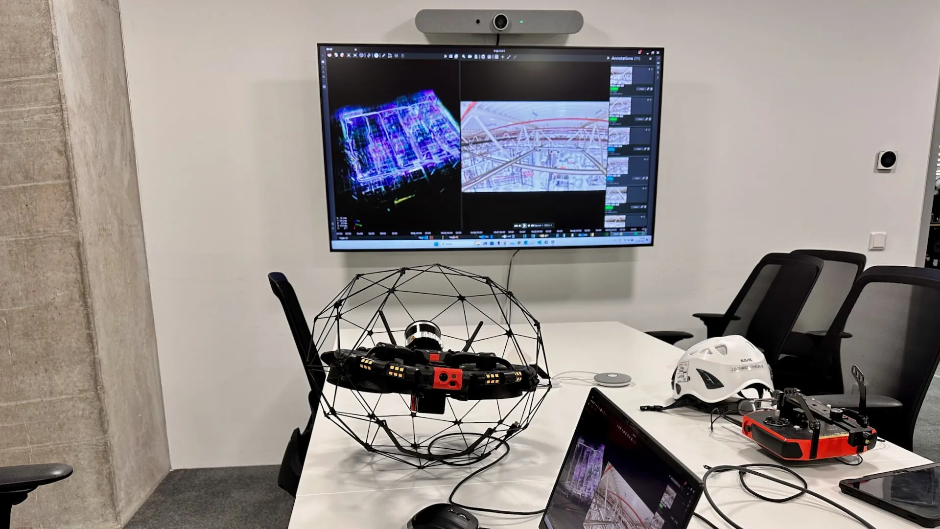
Kopterflug deploys the ELIOS 3 for interiors and the DJI Matrice 30T for exteriors – 4K video, thermography and LiDAR for complete plant documentation. No scaffolding, no human entry, no blind spots. Accepted by TÜV, DEKRA, insurers and authorities.
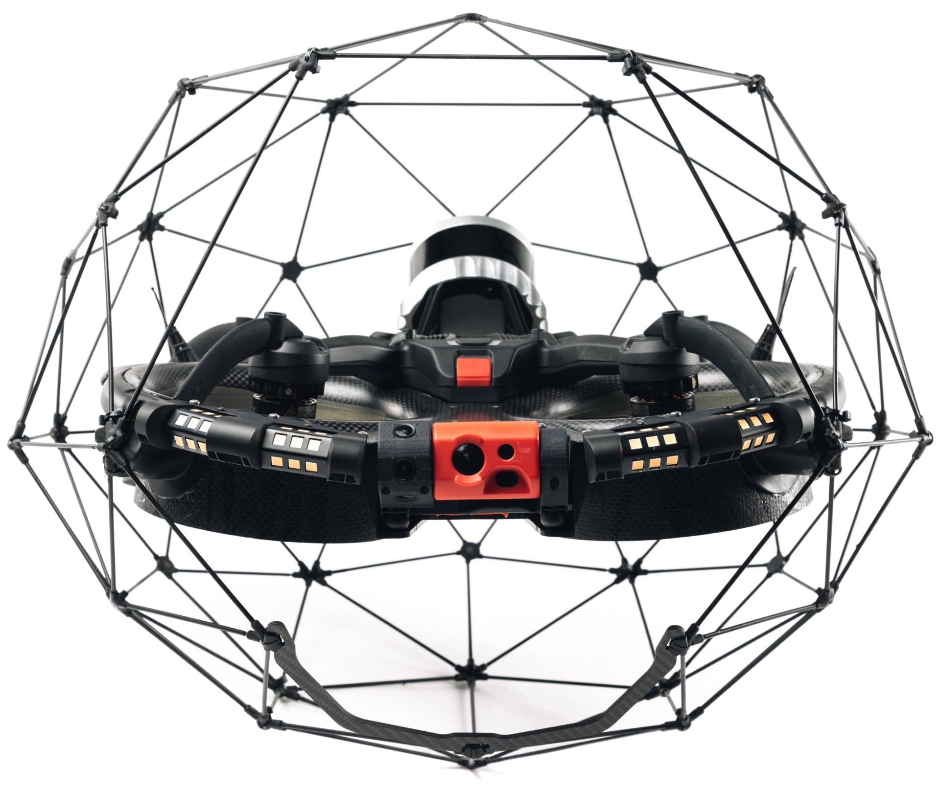
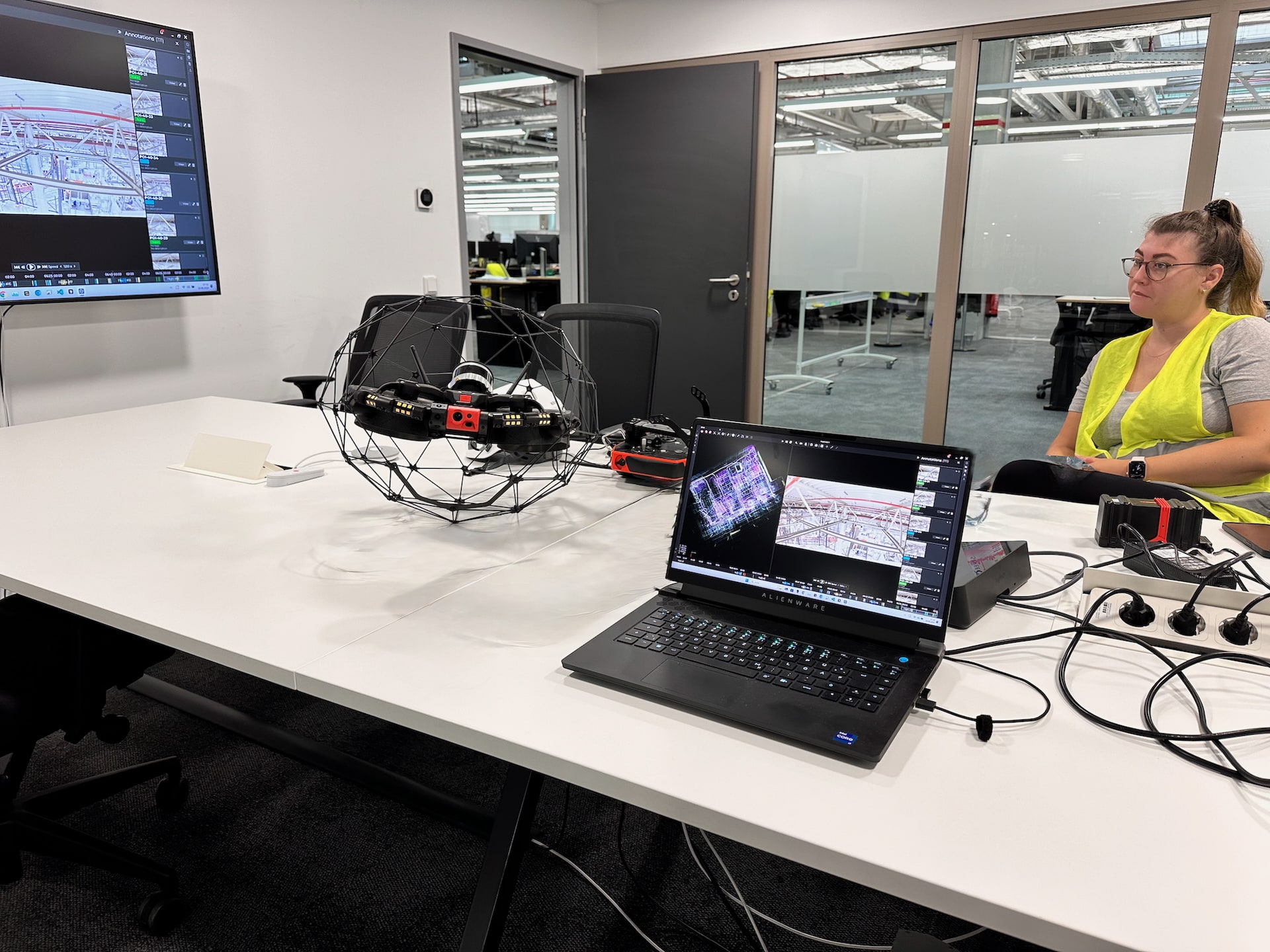
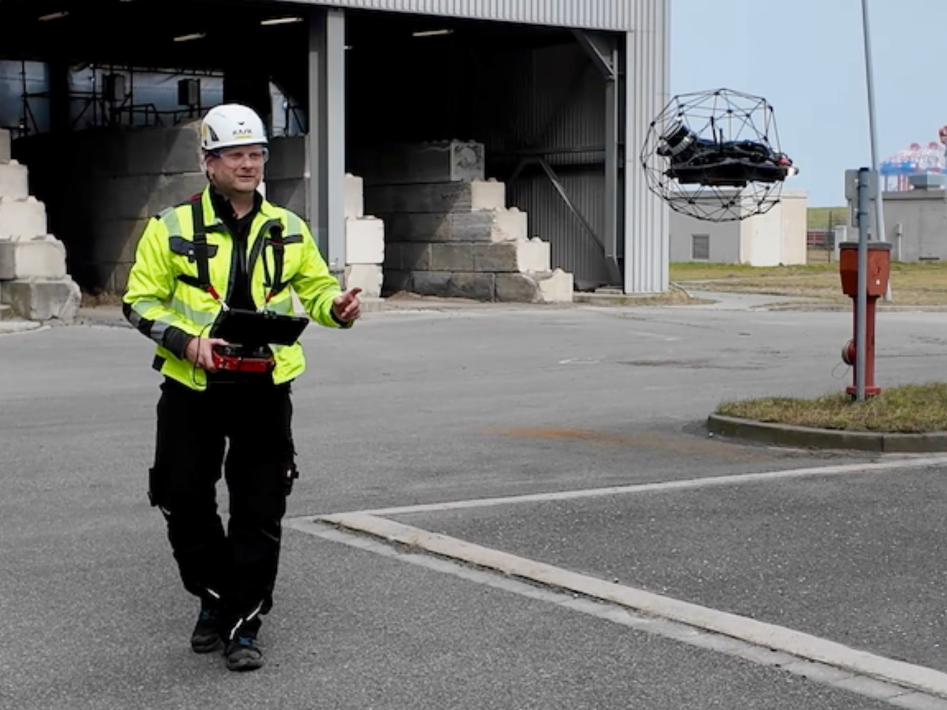
The Flyability ELIOS 3 with its collision-safe carbon cage – built for interior documentation of confined industrial spaces.
Maintenance managers, asset managers and plant operators need a reliable answer to a simple question: What is the condition of my plant – today, provably and completely? Conventional methods deliver photos of accessible areas. Critical locations – interior walls, roof structures, confined spaces, elevated sections – remain undocumented.
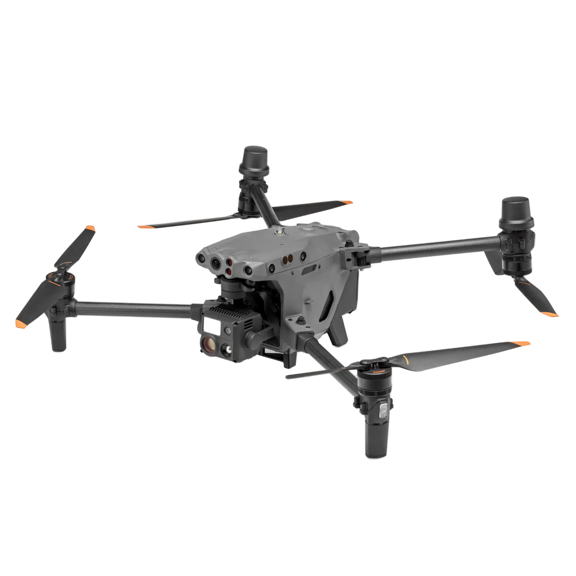
Kopterflug deploys the right system for each area: the Flyability ELIOS 3 (ELIOS 3) for interiors, confined spaces and inaccessible structures – and the DJI Matrice 30T (M30T) for exterior walls, pipe bridges, hall roofs, cooling towers and large-scale exterior areas. For ground-level areas, access routes and spontaneous surveys, we supplement with handheld LiDAR scanners directly on site – no tripod, no preparation. The result: 4K video, thermography and georeferenced LiDAR point clouds for all areas of your plant – a revision-safe inspection report (revisionssicherer Inspektionsbericht) that serves as the basis for maintenance planning, insurance, authorities and independent assessors.
We have worked in heavy industry, chemicals, energy and process industries since 2017. Our clients use condition documentation for operator handovers, recurring inspections under BetrSichV (German Industrial Safety Regulation), insurance evidence, due diligence assessments and maintenance planning.
Photos from accessible areas are not complete condition documentation. Critical locations remain undocumented – and that is precisely where damage originates that nobody has seen.
Interior walls of tanks, boilers, chimneys and silos – conventionally only reachable by scaffolding, climbing teams or personnel entry. That means: cost, time and risk – or the documentation remains incomplete.
Individual photos document points, not surfaces. Thermographic anomalies, geometric deviations and concealed damage remain invisible – until the next incident.
Without systematic initial documentation, there is no reference baseline. Damage only becomes apparent at the next inspection – with no way of knowing when it occurred.
Drain, clean, release, erect scaffolding – conventional inspections often tie up the plant for days. This increases downtime and significantly disrupts operations.
Entering confined spaces (enge Räume), working at height, complex rescue chains – conventional inspection methods bring people into areas that should ideally be avoided.
Every inspection is captured from a different angle, a different position. True condition comparison over years is barely possible – changes remain estimates rather than measurements.
Conventional response involves planning, obtaining permits and erecting equipment – costing days to weeks. In that time, an identified defect often progresses unchecked.
Individual photos do not replace complete datasets. Without 4K video, thermography and 3D point clouds, there is no basis for structured evaluation, reports and subsequent decisions.
Conventional documentation often ends up as a PDF in an archive. Integration into asset management, comparison with previous inspections or handover to assessors is laborious – media breaks are the norm.
Without reproducible baseline recordings, there is no foundation for targeted focus. Inspections capture what is accessible – not necessarily what matters most.
Scaffolding, climbing teams, safety measures, permits – conventional inspections involve many contractors. The actual inspection effort is often smaller than all the surrounding work.
Flyability ELIOS 3 – interior documentation without personnel entry (Personeneinstieg).
Your condition documentation covers all areas – interior and exterior – with the following data streams:
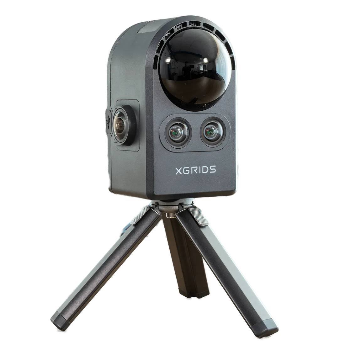
Interior, exterior or underwater – the right system for each plant. The ELIOS 3 is our primary system for confined spaces, the DJI Matrice 30T for exteriors, the Chasing M2 Pro Max for underwater areas and the handheld LiDAR for ground-level surveys.
Tanks, boilers, silos, chimneys – the ELIOS 3 flies where a person with breathing apparatus would otherwise have to enter. GPS-free SLAM navigation, collision-safe carbon cage, 4K + thermography + LiDAR in a single flight.
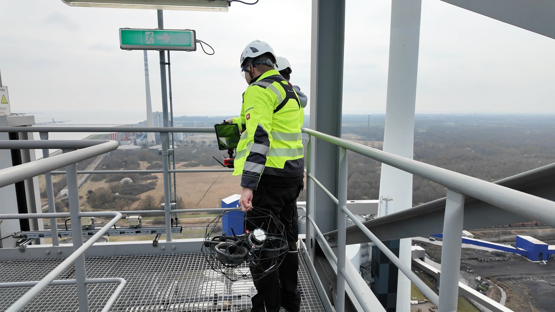
Where the ELIOS 3 ends, the M30T begins: pipe bridges, exterior walls, hall roofs and cooling towers – during live operation, without scaffolding, at safe distance. 4K zoom camera + radiometric thermography in one system.
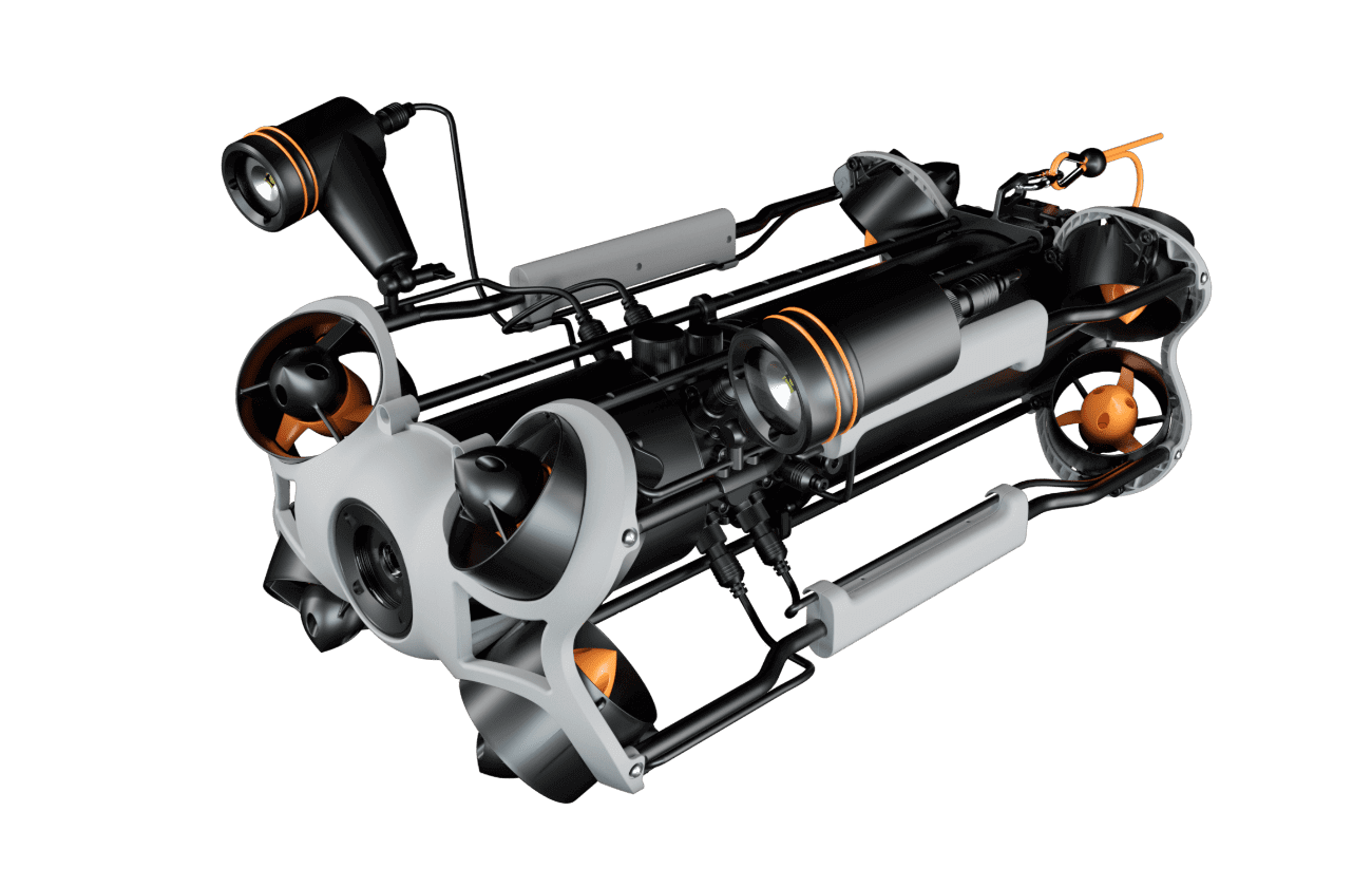
Where drones stop, the M2 Pro Max dives: tank floors, ship hulls, port structures and cooling water inlets – without divers, without draining. Full video documentation underwater.
Spontaneous 3D capture without preparation: LiDAR measures what camera and thermography see – and delivers immediately usable geometry data for as-built surveys, deformation analysis and documentation.
Why drones deliver more – and at significantly lower cost.
| Aspect | Conventional Method | Kopterflug Drone Inspection |
|---|---|---|
| Coverage | Technician with handheld camera – accessible surfaces only | ELIOS 3 + M30T – complete interior & exterior capture, no blind spots |
| Lead time | Scaffolding or confined space entry (Befahrung) for interiors: weeks of preparation | No scaffolding – deployment within a few days |
| Personnel risk | Personnel entry into confined spaces with rescue chain | Zero entry – no rescue chain, no DGUV confined space permit (Befahrerlaubnis) |
| Reproducibility | Photos without coordinates – not reproducible, no trend comparison possible | Time-stamped 4K recordings with GPS – fully reproducible, trend comparison possible |
| Thermal inspection | No thermography – thermal anomalies invisible | Integrated thermography – hotspots, moisture inclusions and insulation damage detected early |
| Geometry data | No geometric data – deformations go unnoticed | LiDAR point cloud – geometric deviations and deformations measurable to centimetre accuracy |
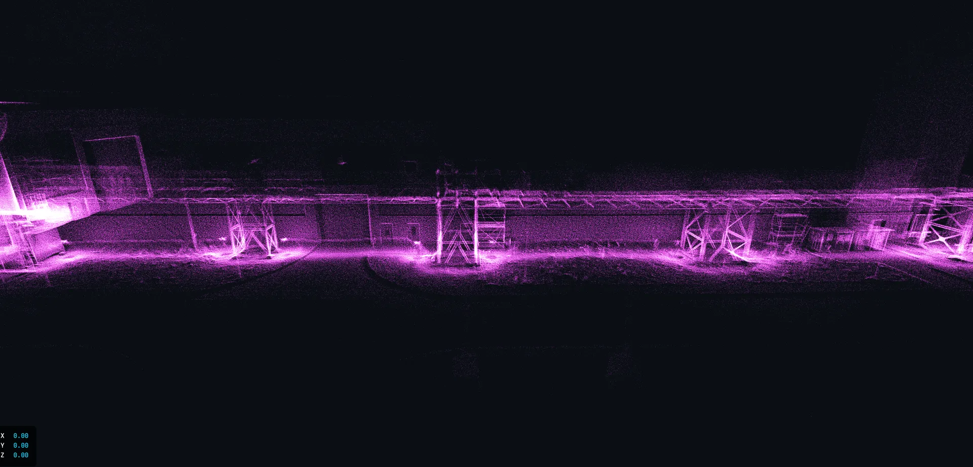
LiDAR 3D point cloud of an industrial pipe bridge – centimetre-accurate geometry data for condition monitoring and deformation analysis.
No generic report – structured data that your inspectors, insurers and maintenance planners can use directly.
Seamless video recordings of all inspected areas – time-stamped, revision-safe, admissible as evidence before authorities and insurers.
All identified findings are documented photographically – with position reference, timestamp and damage classification by severity.
Structured list of all anomalies by location, type and severity – directly usable for maintenance planning and priority setting.
Inspection-ready findings report with photographic evidence, damage classification and action recommendations – compatible with TÜV, DEKRA and assessors.
The protocol is archivable per BetrSichV requirements – suitable as evidence for authorities, insurers and due diligence assessments.
The initial survey serves as a digital reference: at the next inspection cycle, you immediately see what has changed – trend analysis rather than snapshots.
Not sure whether your plant is suitable? We assess feasibility without obligation.
We discuss which plant sections are to be documented, which standards apply and which output format you need – report, 3D model, raw data or all of the above.
You receive a transparent quote with a clear scope of services. We schedule the appointment around your operations – no long lead time, no scaffolding effort.
Our two-person team (pilot + assistant) carries out the flight survey. 4K, thermography and LiDAR simultaneously – systematic and complete. Where the drone cannot reach, handheld LiDAR supplements: ground-level structures, access routes and individual components are surveyed directly on site. Typical on-site duration: a few hours to one day.
You receive the structured inspection report with 4K recordings, thermography evaluation, 3D point cloud and findings overview – inspection-ready and audit-proof.
Since 2017 we have documented industrial plants in power stations, chemical parks, steelworks and ports – throughout Germany. We know what matters for revision-safe documentation (revisionssichere Dokumentation) and deliver data that your inspectors and insurers accept.
A two-person team (pilot + assistant) carries out the flight survey with the ELIOS 3 (interiors) and DJI Matrice 30T (exteriors). 4K video, thermography and – when required – LiDAR 3D data are captured simultaneously. After the deployment, raw data is processed, anomalies are classified and a structured report is produced. Typical timeline: a few hours to one day on site, report within a few working days.
You receive: 4K video of the complete survey (time-stamped, revision-safe), high-resolution photos of all anomalies with position references, a structured findings list by location, type and severity, a PDF findings report with action recommendations, and – when LiDAR is used – a georeferenced point cloud (E57, RCP) as a baseline for follow-up surveys. The protocol is archivable per BetrSichV (Betriebssicherheitsverordnung, German Industrial Safety Regulation).
Your own maintenance teams document only what is accessible – and with handheld cameras without coordinates, thermography or a reference baseline. Our drones capture interior walls, ceilings, elevated sections and confined spaces completely: 4K video with timestamp, GPS coordinates, thermal imaging and LiDAR measurement data. The result is reproducible, revision-safe and accepted by TÜV, DEKRA, insurers and authorities.
Condition documentation (Zustandsdokumentation) is carried out preventively and records the reference condition of a plant at a defined point in time. Damage documentation (Schadensdokumentation) takes place after an event – for example an incident or defect – and serves as evidence and assessment of cause and extent. Both benefit from a current reference condition documentation as a starting baseline.
Yes. Time-stamped 4K recordings with GPS coordinates, a structured findings report and a revision-safe protocol are usable as evidence before authorities, insurers, assessors and in legal proceedings. Our documentation is compatible with the requirements of TÜV, DEKRA and standard insurance conditions. It serves as the basis for evidence under BetrSichV and for due diligence assessments.
Insurers typically expect: a verifiable initial condition prior to the loss event (date, plant, condition), seamless photo documentation of all relevant areas, a findings list with damage classification, and a revision-safe protocol. Our documentation covers all these requirements – and allows the time and extent of damage to be clearly evidenced in the event of a claim.
It is especially valuable: before planned maintenance operations (clear priority basis), in preparation for recurring inspections under BetrSichV, after incidents or unusual events, during operator handovers or due diligence assessments, and as initial documentation for long-term condition monitoring.
The drone reaches its limits with: pipes and ducts below DN 600 (too narrow an opening), ATEX zones without corresponding clearance, contact-based non-destructive testing (NDT) methods that are mandatory (ultrasonic wall thickness measurement, magnetic particle testing, dye penetrant testing), temperatures outside −10 to +55 °C, and legally prescribed inspections by qualified inspection personnel. In these cases, the drone can supplement conventional inspection, but not fully replace it.
The effort on your side is low: you define the scope (which plant sections), ensure accessibility to the deployment area and coordinate the date and interface with your plant safety team. For interiors, a brief shutdown or emptying is often required; for exterior areas, documentation frequently runs during live operation. We conduct the initial discussion to clarify the actual preparation effort for your specific plant.
On-site capture takes typically a few hours to one day, depending on plant size and complexity. The structured inspection report with 4K recordings, thermography evaluation and findings overview is delivered within a few working days after the deployment. For LiDAR recordings including point cloud processing, the delivery time may be slightly longer – we communicate this transparently in advance.
Yes – this is one of the key advantages. With the initial documentation as a digital reference, you immediately see at the next inspection cycle what has changed: corrosion progress, new anomalies, geometric changes. Trend analysis rather than snapshots – enabling data-driven maintenance planning instead of reactive repairs.
Typical applications: tanks and pressure vessels (Druckbehälter), boilers and heating systems, silos and bunkers, chimneys and cooling towers, pipe bridges and hall roofs, port structures and water-filled containers. We work in power stations, chemical parks, refineries, steelworks, paper mills and food production – wherever plants must be regularly inspected and provably documented.
Partly. Exterior areas, pipe bridges, hall roofs and many exterior walls are documented during live operation – without downtime. For interiors (tanks, boilers, silos), a brief shutdown or emptying is usually required. Compared to conventional scaffolding entry, however, the operational interruption is considerably shorter.
Thermography (Thermografie) makes conditions visible that are not yet optically apparent: insulation damage (Isolationsschäden), moisture inclusions, hotspots at electrical components, heat losses through cracks or voids. In condition documentation, this enables early warning – defects are identified before they become costly or lead to failures.
The effort depends on: plant type and size, accessibility of the areas to be documented, sensor systems deployed (4K, thermography, LiDAR), the required report scope, and the number of plant sections. After a brief initial discussion, you receive a transparent fixed-price quote with a clear scope of services.
In most cases: yes. The ELIOS 3 documents tanks, boilers, silos and chimneys completely from the inside – without scaffolding, without DGUV confined space entry (DGUV-Befahrung), without a rescue team. The M30T captures exterior walls, pipe bridges and hall roofs from safe distance. Where no person needs to enter, setup time, safety effort and coordination all fall away.
We deliver LiDAR point clouds as standard in E57 format (ISO/ASTM standard) as well as RCP/RCS for direct import into Autodesk software. On request we also export in LAS/LAZ, PLY or XYZ – depending on which system your planning or maintenance department uses. The data is georeferenced and can be imported directly into BIM models, CAD environments or GIS platforms.
Yes. Findings reports are delivered as structured PDF files, the findings lists additionally as Excel or CSV exports with position data, damage classification and severity rating. This data can be imported directly into common CMMS systems such as SAP PM, IBM Maximo or Ultimo. On request we adapt the export structure to your existing workflows and data fields.
For follow-up surveys we use the initial documentation as a digital reference basis. LiDAR point clouds are overlaid (cloud-to-cloud comparison) so that geometric changes – such as deformations, settlements or material loss – become visible to millimetre accuracy. Visual findings are compared using identical camera positions, thermography data reveals changes in the thermal profile. The result is an objective trend analysis across multiple inspection cycles.
A digital twin is a three-dimensional, dimensionally accurate representation of your plant based on LiDAR data and 4K imagery. It enables you to virtually walk through plant areas, spatially locate findings and plan maintenance measures on the model – without another on-site deployment. In combination with recurring documentations the digital twin becomes a living condition record of your plant.
Retention obligations depend on the respective legal basis: BetrSichV inspection protocols must be retained at least until the next recurring inspection; insurance-relevant documents typically for the entire contract period. We deliver all data in open, long-term archivable formats (PDF/A, E57, TIFF) and on request with a structured folder structure that facilitates audit-proof filing in your document management system.
Our condition documentation is aligned with the requirements of BetrSichV, VDI 2862 (bolting technology documentation), DIN EN 13018 (visual inspection) and industry-standard guidelines for industrial inspections. Findings reports contain all mandatory information for inspection protocols: inspection date, inspection object, methods used, findings classification and action recommendations. The result is a report that stands up before TÜV, DEKRA and insurers.
Questions about condition documentation or need a quote for your plant? Fill out the form below and we will get back to you within 24 hours.