
LiDAR & 3D Scanning in Industrial Inspection – Point Clouds from Confined Spaces
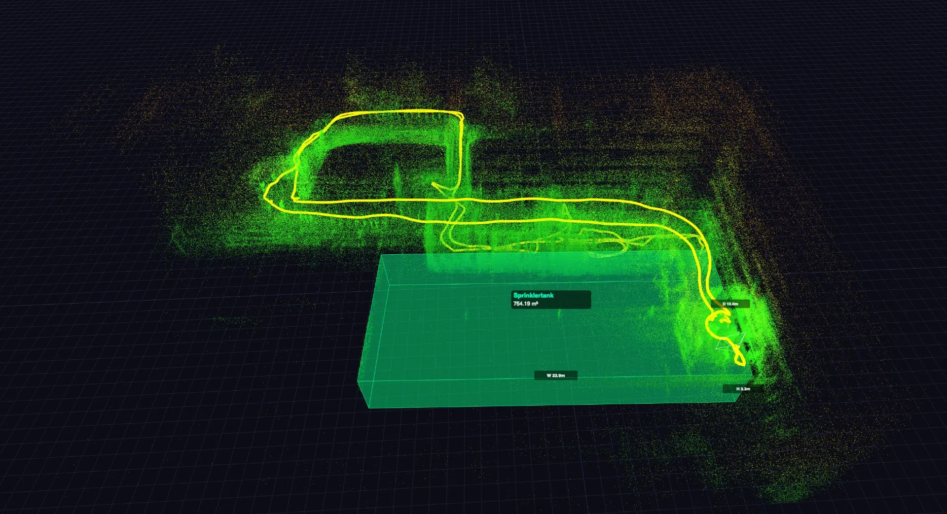
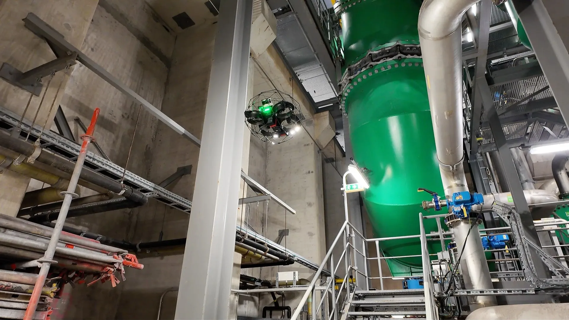
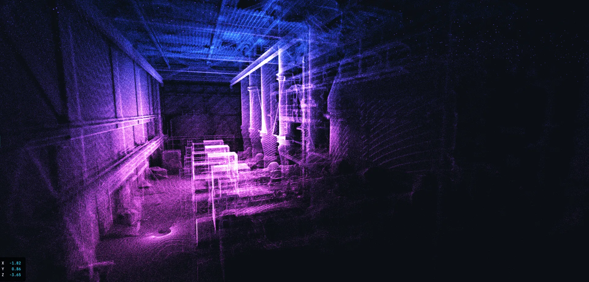
The ELIOS 3 carries an Ouster OS0-128 LiDAR sensor directly through the manhole into tanks, boilers and silos. While it flies, it generates a centimetre-accurate 3D point cloud in real time – without scaffolding, without human entry, without GPS.
- Centimetre-range precision – Ouster OS0-128, 1.31 million points/second
- Works in total darkness – LiDAR is active, needs no light
- CAD/BIM-compatible output – .las and .e57 formats
- Colourised point clouds since 2025 – automatic RGB texturing in Flyability Cloud
LiDAR Scanning in Confined Spaces: The Problem – and the Solution
Classic 3D scanning (terrestrial laser scanner) works excellently – when you can bring the scanner into the space. In a tank through a DN 600 manhole, in an 80-metre-high chimney, in a dusty silo? Barely possible without enormous effort.
The Flyability ELIOS 3 carries an Ouster OS0-128 Rev 6 LiDAR sensor directly through the manhole into the vessel. While it flies, it generates a 3D point cloud in real time – without scaffolding, without human entry, without GPS.
The result: A centimetre-accurate 3D model of your plant that serves as the basis for surveying, deformation analysis and digital twins.
ELIOS 3 LiDAR: Technical Core Data
LiDAR sensor: Ouster OS0-128 Rev 6
- Precision: centimetre range (1σ)
- Range: up to 100 m
- Points per second: 1.31 million
- Channels: 128
- Protection class: IP68 (waterproof, dustproof)
SLAM algorithm: FlyAware™ Engine
- GPS-independent navigation and mapping
- Real-time 3D live map during flight
- Computer Vision + LiDAR + NVIDIA processor
Output formats:
- .las / .e57 (CAD/BIM-compatible)
- .ply (mesh)
- Colorised Point Cloud (since 2025: automatic RGB texturing)
Post-processing: Flyability Cloud (Inspector 5) – measurement, annotation, reporting, export.
What Can You Do with LiDAR Point Clouds?
The LiDAR point cloud from the ELIOS 3 is far more than a 3D image – it is a versatile data foundation for a wide range of analyses.



Colorization: Coloured 3D Models since 2025
Since the 2025 update, Flyability Cloud offers the Colorization function: the LiDAR point cloud is automatically overlaid with the 4K camera images, creating a photo-realistic 3D model.


LiDAR vs. Photogrammetry: Which Is Better for Confined Spaces?
Photogrammetry (3D from photos) works well with good lighting and textured surfaces. In confined spaces it is problematic: darkness (even with lighting: shadows, reflections), uniform surfaces (bare tank walls), narrow passages (insufficient image overlap).
LiDAR is superior for: darkness (LiDAR is active, needs no light), uniform surfaces (measures distance, not texture), large volumes (100 m range), precise surveying (centimetre range), real-time navigation (SLAM).
| Criterion | LiDAR (ELIOS 3) | Photogrammetry |
|---|---|---|
| Works in darkness | ✓ Yes | ✗ Needs light |
| Uniform surfaces | ✓ (measures distance) | ✗ Needs texture |
| Large volumes (>50 m) | ✓ (100 m range) | ⚠ Limited |
| Precision | Centimetre range | cm range |
| Real-time navigation (SLAM) | ✓ Yes | ✗ No |
| Coloured 3D models | ✓ (Colorization) | ✓ (natively coloured) |
| Dust / steam | ⚠ Reduced range | ✗ Image artefacts |
| Confined space suitability | ✓ Superior | ✗ Problematic |
For confined spaces, LiDAR is the superior technology. Photogrammetry can be used as a supplement – but the foundation is LiDAR.
Practical Examples: LiDAR Scanning with the ELIOS 3
All examples anonymised. Duration and results are project-specific.

Limits of Drone-Based LiDAR Scanning

Your Contact
Project Manager & LiDAR Expert
LiDAR scanning in confined spaces has been our core capability since 2017. The ELIOS 3 reaches places where no terrestrial scanner can be positioned – and delivers centimetre-accurate 3D data.
Related Services
- Flyability ELIOS 3 – The indoor drone with integrated LiDAR sensor for precise 3D point clouds
- Industrial Inspection – LiDAR-supported industrial inspections with digital twins and surveying
- Tank Inspection – Survey tanks by LiDAR 3D scan and capture deformations to the centimetre
- Silo Inspection – Scan silos by drone and determine residual volume via LiDAR point cloud
- Chimney Inspection – Document chimney geometry and lining by LiDAR 3D scan
Frequently Asked Questions: LiDAR & 3D Scanning
- How accurate is the LiDAR survey of the ELIOS 3?
- Point precision is in the centimetre range (1σ). For industrial surveying and deformation analysis this is sufficient in most cases. For sub-centimetre accuracy a terrestrial scanner would be needed – which often cannot be brought into confined spaces.
- Can I import the point cloud into my CAD system?
- Yes. The ELIOS 3 delivers .las and .e57 formats that can be imported into standard CAD systems (AutoCAD, Revit, BIM 360, CloudCompare, FARO SCENE and others).
- How long does a LiDAR scan with the drone take?
- This depends on the size and complexity of the space. Flight time varies depending on plant size and sensor scope. Post-processing (colorization, surveying) comes afterwards – varying in duration depending on requirements. Contact us for an estimate for your specific situation.
- Does a drone LiDAR scan replace a terrestrial 3D scan?
- In confined spaces: in many cases yes, because a terrestrial scanner simply cannot be positioned there. In freely accessible areas terrestrial scanners offer higher accuracy (sub-mm). The ideal solution is often a combination: drone for interior spaces, terrestrial scanner for accessible areas.
Contact – LiDAR Scanning Enquiry
We scan your confined spaces with LiDAR and deliver point clouds, 3D models and surveying data – without human entry.